")
")
In 2022 and 2023, members of the DuFAULT project research team, Bruno Tomljenović and Marin Sečanj, conducted geological field work in the wider Dubrovnik epicentral area, i.e. in the area of Dubrovnik-Neretva County, Herzegovina-Neretva Canton and the southern part of Republika Srpska (Bosnia and Herzegovina; BA). The aim was to visit the main tectonic contacts and deformation structures and to carry out structural-geological measurements to verify and supplement existing geological data from published geological maps. During 15 days of field work (April, May and October 2022 and April 2023), 88 observation points were made. During eight days of geological field work in April and May 2022, we've visited:
- thrust contacts separating the tectonic units of Pre-Karst and High Karst (in the vicinity of Nevesinje, BA),
- thrust contact between High Karst and Dalmatian tectonic units (in the vicinity of Slano, Croatia),
- epicentral area of the Berkovići earthquke series were no coseimic ground effects were noticed except for rock-falls,
- certain segments of significant faults and deformation structures within the tectonic units of High Karst and Dalmatian zone, i.e. route Ston (HR)-Stolac-Berkovići (BA), route Slano (HR)-Orahov Do-Ljubinje (BA) and route Trebinje-Ljubovo-Kunja Glavica (BiH).
The most attention was focused on Ljubovo (BA)-Plat (HR) and Trebinje (BiH)-Vodovađa (HR) strike-slip faults, as well as on the series of reverse faults and associated deformation structures on the route Oraho Do-Zavala (BA) and in Prapratno on Pelješac peninsula (HR). At the mentioned observation points we've verified existing structural data from published geological maps, and filled the gaps with our own measurements along with identified deformation structures that were not previously recognized or for some reason not included on the extisting geological maps. In addition to geological field work, immediately after a strong earthquake that occurred on April 22, 2022 near Berkovići (ML=6.0), we have installed temporary seismological station DF03 near Nevesinje on the Alegovac dam (BA).
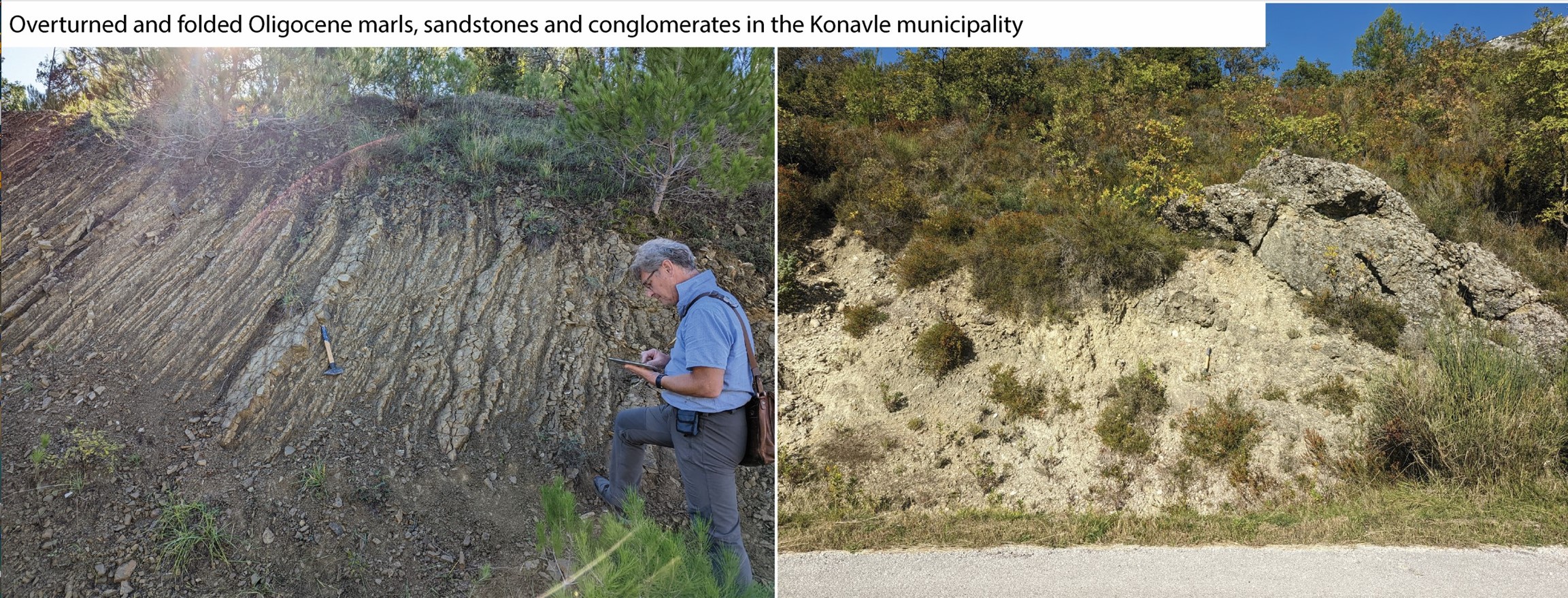
Geological field work continued in October 2022 for seven days. We’ve visited the remaining segments of the of the Ljubovo (BA)-Plat (HR) and Trebinje (BA)-Vodovađa (HR) strike-slip faults, leftover from previous field work in April and May. Field work continued along the High Karst nappe and related deformation structures in the municipality of Konavle and on the Gornji Brgat (Croatia)-Bileća (BA) route. Also, the Neogene basin, located in the hanging wall of the Pre-Karst tectonic unit frontal thrust, in the vicinity of Gacko (BA) was visited in order to see is it deformed or not, which could help us to place certain phases of the Pre-karst and High-karst tectonic unit uplifts in a certain period in time. Within the High-karst tectonic unit, on the Gacko-Trebinje route, we’ve visited segments of internal thrust sheet in the vicinity of Ključ village (BA) and also a few segments of the Ljubinje-Trebinje thrust fault, especially areas where there was no structural data available from published geological maps. In addition to the aforementioned, we’ve visited the island of Sveti Andrija, located 3.5 km south of the island of Šipan in the Dubrovnik archipelago, within the Dalmatian tectonic unit. For the island of Sv. Andrija there is no geological data available, therefore we‘ve made several observation and measurement points across the island and took few rock samples for the classification and age determination. According to the results of the petrographic analysis it has been determined that the island is built out of Upper Cretaceous limestones (Gornji Humac formation). Accompanied with our structural measurements, this results enables us to directly correlate data with offshore 2D seismic profiles that surround the island. In addition to geological field work, we’ve also visited the temporary seismological station DF02 in Bileća (BA) in order to fix the malfunctioned communication unit. Seismological station was successfully fixed and set back into operation, with continuous real-time data transfer to the main server in Zagreb.
All the structural-geological data obtained from the field work will be used for the reconstruction of geological setting, i.e. regional geological and seismotectonic cross-sections and 3D structural geological model.